What’s the elevation of Maritime Race Weekend? Race director Michelle reveals course details
Wondering what kind of elevation runners see at Maritime Race Weekend? Michelle Kempton graphs her routes.
I’ve had “create elevation maps” on my to-do list for five years. With technology, it’s not hard to make elevation maps, I just hadn’t gotten around to it yet. This week the Maritime Race Weekend, elevation maps were finally revealed and to my surprise it caused a surge in registration and generated excitement on social media. Now, I wish that the files were created a long time ago.
RELATED: How my race boosted my local economy
RELATED: Hit the hills for stealthy speed work
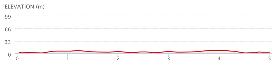
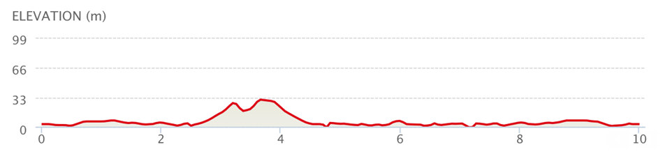
It’s well-known within the local running community that you can set personal bests at Maritime Race Weekend – especially on the flat 5K and 10K routes.
SUNRISE 5K
COASTAL 10K
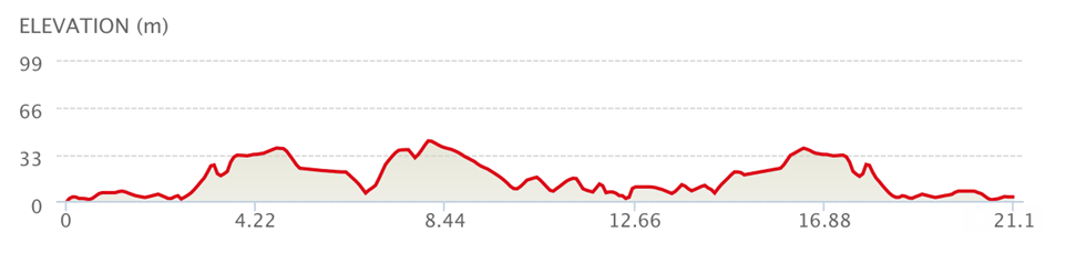
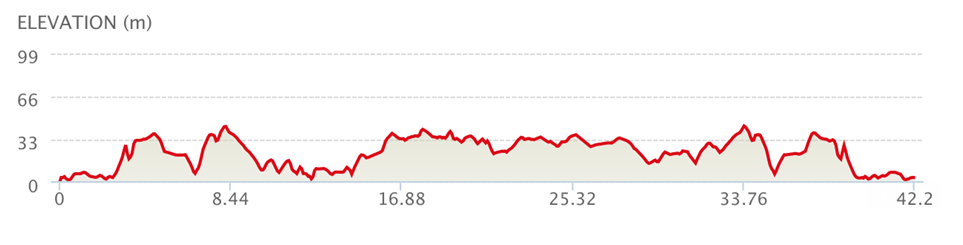
The half-marathon and marathon elevation maps look scary compared to the shorter distances, but the routes are no more hilly than most Nova Scotia events. There definitely are rolling hills, but some runners like that and we get reports of PBS on this route too. We have seasoned pirates who return every year for the half-marathon. They enjoy the breathtaking views along the coastline route and find it hard to resist the refreshing salt air that’s included with registration.
SCENIC HALF-MARATHON
CLASSIC MARATHON
Check out the latest buyer's guide: