Canadian Trails – Saskatoon’s River Path
A stretch of paved and dirt trails along the south Saskatchewan River can provide everything from an easy job to challenging workouts for any type of runner.
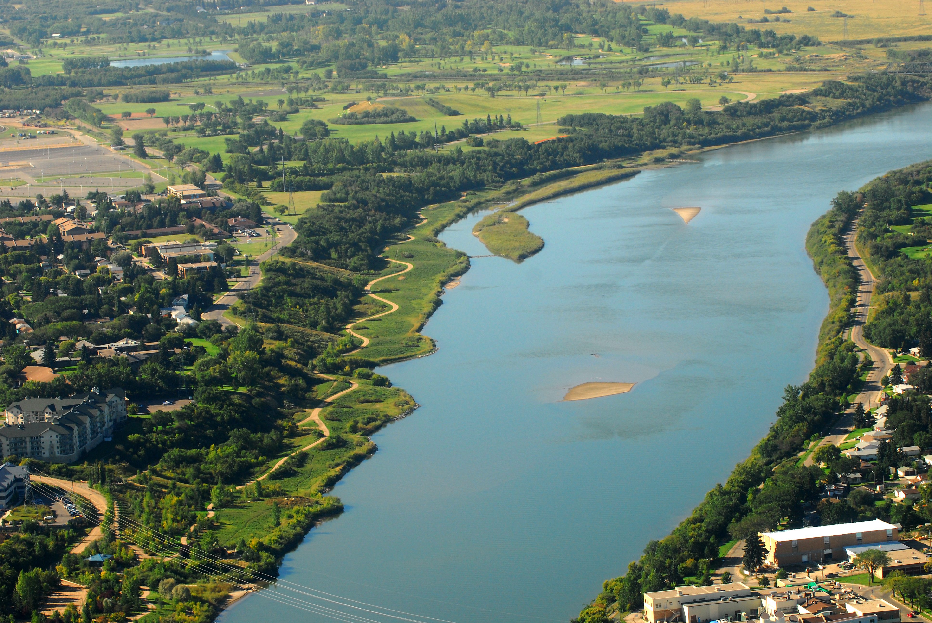
Jogging through the forest of willow, aspen and chokecherry, with warblers and finches darting across the path, it’s easy to forget you’re passing through the downtown core of a city of 250,000. Emerging from one of the many woodchip, dirt or crushed-rock trails of the Meewasin Valley, the South Saskatchewan River comes into view, as do the cathedrals, hotels and building cranes dotting Saskatoon’s skyline. The valley, which takes its name from the Cree word for “beautiful,” is home to more than 40k of trails. Except for a 1k stretch where some of the city’s oldest (and most expensive) houses sit, the entire riverbank valley has remained accessible to the public.
The Meewasin Valley Authority, the product of a partnership between various governments and the University of Saskatchewan, has protected this corridor from development and allowed wildlife to thrive. Accessible from almost any point along the river, whether inside or outside the city, residents and visitors can walk, run or bike on an ever-expanding network. The marked, 12k urban loop bordered by the Senator Sid Buckwold and Circle Drive Bridges is a paved, multi-use section on the ridge of the riverbank. However, trail running enthusiasts can easily find multiple, parallel dirt, grass or woodchip routes closer to the water.
Near the south end of Saskatoon is Gabriel Dumont Park, named for the military leader of the Metis resistance of 1885. Enter the parking lot just south of the corner of 8th Street and Saskatchewan Crescent. It’s a five minute drive or 20-minute jog from downtown. Beginning near the Trans Canada Trail pavilion, head south on this gently rolling crushed rock, 3k trail surrounded by waist-high natural grasslands just metres from the shore.
If you are up for a bit longer workout, take the trail up to the top of the bank just before the newly constructed Circle Drive South Bridge (complete with hanging sidewalk). Do a 2k loop of the soft woodchips in Diefenbaker Park before heading back.
A 10-minute drive south of the city, the Beaver Creek Conservation Area offers more challenging terrain than the urban trails. Primarily an educational site for school groups and researchers, trail runners can find a wide variety of routes. From the parking lot, there are several kilometres of f lat, packed sand trail through the grasslands. Once you’re warmed up, run around beaver dams on one of the four semi-wooded, narrow trails.
If you want to explore the other side of the Meewasin, travel a few kilometres north on Central Avenue past the Regional Psychiatric Centre to a small dirt parking lot. Here you’ll find the trailhead for Crocus Prairie, an ecologically pristine sight named for the flower which grows there in abundance. It’s easy for even seasoned athletes to get a tough 90-minute workout using the Crocus route and the adjoining Sutherland Beach trail. These trails provide a view of Wanuskewin Heritage Park across the river, an ancient gathering site for First Nations peoples.
Check out the latest buyer's guide: