Canadian researchers map geographical causes of obesity

One researcher from the University of Western Ontario, Jason Gilliland believes that causes of obesity can be mapped. He has teamed up with others at the university’s Human Environments Analysis Lab to map the factors that lead to obesity in children. Their focus was on southwestern Ontario.
Reported initially by Canadian Geographic, Gilliland’s research points to three major influences of obesity. The first one that he mapped was access to healthy foods (or grocery stores). He found that when looking at southwestern Ontario, there were areas that were completely void of grocery stores with the closest one being 35 kilometres away. Most of these areas were very small towns. The link between the lack of supermarkets and obesity is fairly obvious: where there is no store with fresh produce and healthy options, people are more likely to rely on less nutritious substitutes (There was no mention of farmer’s markets or community gardens in his study.)
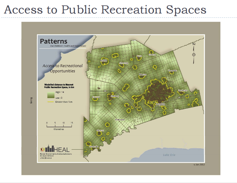
The second factor that the team mapped was access to green space or exercise facilities. Gilliland found that areas that had more places to get physically active saw a more active community. Kids in particular were more likely to choose to pursue physical activity.
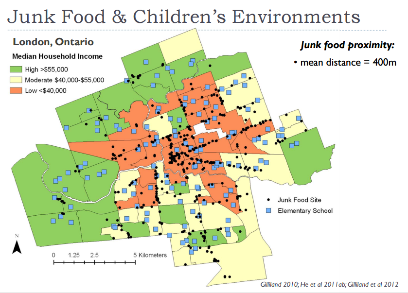
Finally, he mapped accessibility to junk food within a 500-metre walk of elementary schools. Placesthat were defined as “junk food” venues here were fast food restaurants and convenience stores which provide kids with an array of unhealthy foods like candy, pop and chips. When elementary schools were located far from these spots, kids were forced into making healthier choices.
Check out the latest buyer's guide: